Make sure that this Visualization index contains a plain text field names 'Map_Location' and that locations are added to this field. The format is the latitude followed by the longitude separated by a comma. For example, '40.7142691,-74.0059729' to locate New York.
If you do not see the Visualization buttons, enable them via the Web Client Options.
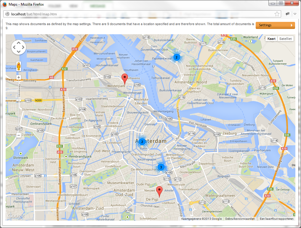
Markers indate the location of documents. Click on a marker (red for one document on that location, blue for two or more documents on that location) to reveal a dropdown with document field information. Select to open the document.

The Timeline options window will appear.
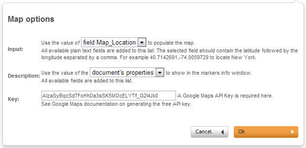
- For both the Input and the Description a dropdown list is shown with the available fields. If no additional fields are available only one option can be chosen.
- A Google Maps API key is needed to view the locations on the map. Instructions to obtain the API key can be found here: https://developers.google.com/maps/documentation/javascript/tutorial?hl=nl#api_key